Home › Churches › Pays de la Loire
Fougeré
FOUGERÉ (Maine-et-Loire)
La paroisse de Fougeré paraît exister dès la fin du XIèmesiècle. La terre, titrée de Baronnie, comprenait de nombreux petits fiefs avec châteaux et manoirs des XVèmeet XVIème siècles : l'Aulnière, Gâtine, la Dosdeferrière, la Gauleraie, la Flosselière, la Perdrière. Le village, groupé au pied de la flèche torse de l'église Saint Etienne, compte plusieurs demeures du XVIIème et XVIIIème siècles, dont le presbytère couvert d'une toiture à comble brisé. Ce village comprend actuellement une population de 760 habitants après avoir eu un maximum de 1593 habitants au début du XIXème siècle (1831). Situé sur la bordure nord-ouest du plateau Baugeois qui culmine à 90-100 mètres, il occupe une surface de 2 418 hectares. Trois cours d'eau drainent cet espace, le Verdun qui coule à quelques centaines de mètres à l'est du bourg et deux affluents, le Grez et le Follet, qui passent à l'ouest, au pied de l'église après leur confluence.
Max Thibault, Maire
The parish of Fougeré seems to have existed as early as the late 11th century. The land, which was a barony, consisted of numerous small fiefs each with its own châteaux and manors dating back to the 15th and 16th centuries: the Aulnière, Gâtine, the Dosdeferrière, the Gauleraie, the Flossselière, the Perdrière. The village, clustered around the spiral spire of the church dedicated to Saint-Etienne, has several 17th and 18th-century mansions, including the presbytery with its dual-pitch roof. The village now has a population of 760 inhabitants, though there used to be a maximum of 1593 inhabitants in the early 19th century (1831). Situated on the north-west edge of the Beaugeois plateau, which reaches an altitude of 300 feet, it has an area of 5975 acres. The area is watered by three streams, the Verdun flowing a few hundred yards east of the village and two tributaries, the Grez and the Follet, flowing at the foot of the church after their confluence.
Max Thibault, Mayor
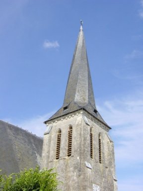
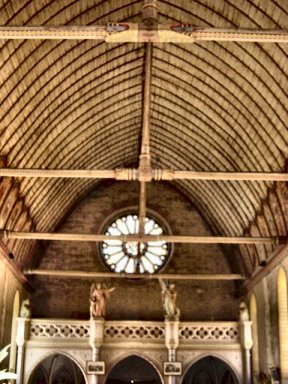
Clocher du XIIèmesiècle et flèche torse - 12th-century tower and spiral spire
The church dates back to the 11thcentury but underwent numerous alterations in the 16thand 19thcenturies. The wall of the nave were erected in the late 11th or early 12thcentury. The arch of the southern doorway is typically Romanesque, with its two rows of interlocking arch-stones (engrenures). In the 19thcentury, the nave was pierced with large windows to replace the narrow Romanesque openings and a bay was added. The 12th-century tower is surmounted by one of the few spiral spires in the region. The 13th-century choir is a good example of Plantagenet vaulting.
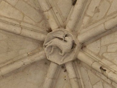
The keystones of the Plantagenet vault of the choir are cerved with various figures: angels, mystic Lamb, God, Orant.
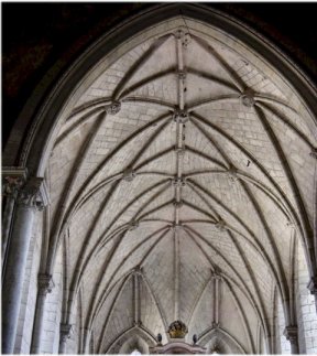
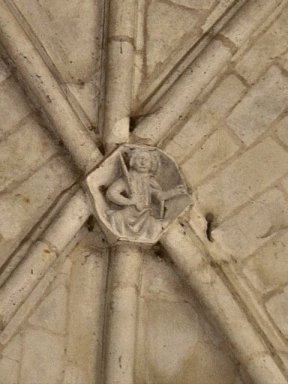
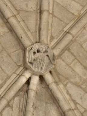
Voûte de la nef - Vault of the nave ******* Clefs de voûte: anges - Keystones: angels
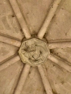
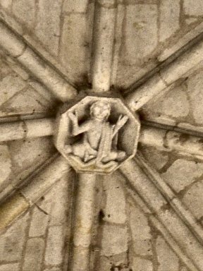
Clef de voûte: Orant - Keystone: Orant
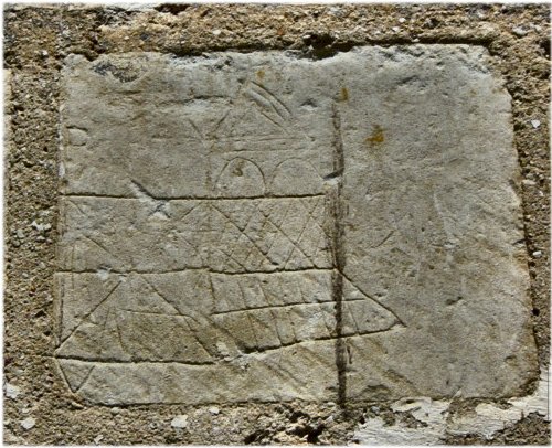
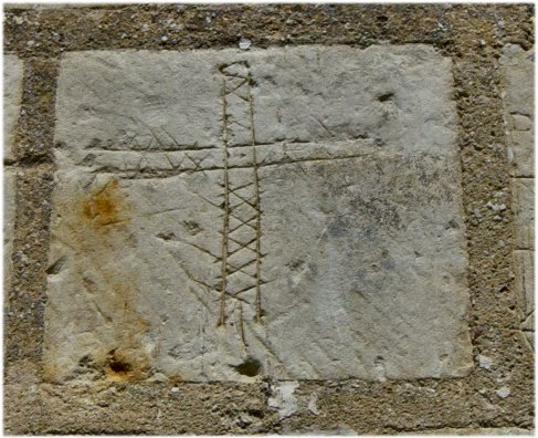
Much less common, are the graffiti discovered on the northern exterior wall of the nave: probably carved by crusaders, they represent a cross, the fall of Antioch and the walls of Jerusalem.
Location and nearby churches
- Montpollin 4.7 km
- Bazouges-sur-le-Loir 6.9 km
- Durtal 9.0 km
- La Flèche 9.9 km
- La Flèche 9.9 km
- Jarzé 10 km